RESEARCH PROJECTS
PI-CASC supports research that generates actionable climate science within several key focus areas defined by regional stakeholder needs.
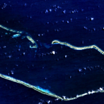
Collecting elevation data to understand climate change effects in the Marshall Islands
PI: Jeffrey Danielson , Physical Geographer, USGS Earth Resources Observation and Science (EROS)
Co-Is: Monica Palaseanu-Lovejoy, Research Geographer, USGS Eastern Geographic Science Center; Cindy Thatcher, Research Biologist, Cooperative Data Acquisition, NGPO; Dean Gesch, Research Scientist, USGS Earth Resources Observation and Science (EROS) Center; Matthew Barbee, Biologist, UH Mānoa; Romina King, Asst. Professor of Geography, University of Guam; Maria Kottermair, GIS specialist, University of Guam
Funded: FY2016
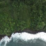
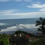
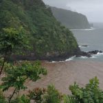
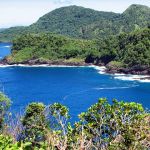
Estimating coastal erosion rates on Hawai‘i Island to inform setbacks
PI: Ryan L. Perroy, Associate Professor of Geography and Environmental Science, UH Hilo
Co-PI: Rose Hart, Tropical Conservation Biology & Environmental Science, UH Hilo
Collaborators: Steven Colbert, Assistant Professor of Marine Science, UH Hilo; Charles Fletcher, Professor of Geology & Geophysics, UH Mānoa
Funded: FY2016
Co-PI: Rose Hart, Tropical Conservation Biology & Environmental Science, UH Hilo
Collaborators: Steven Colbert, Assistant Professor of Marine Science, UH Hilo; Charles Fletcher, Professor of Geology & Geophysics, UH Mānoa
Funded: FY2016
Assessing the vulnerability of coastal wastewater infrastructure to climate change
PI: Daniele Spirandelli, Asst. Professor of Coastal Policy & Community Development, UH Mānoa
Co-PI: Theresa Dean, Department of Urban and Regional Planning, UH Mānoa
Collaborators: Roger Babcock, Professor of Civil and Environmental Engineering, UH Mānoa; Suwan Shen, Assistant Professor of Urban and Regional Planning, UH Mānoa
Funded: FY2016
Co-PI: Theresa Dean, Department of Urban and Regional Planning, UH Mānoa
Collaborators: Roger Babcock, Professor of Civil and Environmental Engineering, UH Mānoa; Suwan Shen, Assistant Professor of Urban and Regional Planning, UH Mānoa
Funded: FY2016
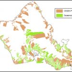
Understanding future sediment transport to coastal waters and coral reef ecosystems in West Maui
PI: Kirsten Oleson, Asst. Professor of Ecological Economics, UH Mānoa
Collaborator: John Stock, Research Geologist, USGS
Funded: FY2015
Collaborator: John Stock, Research Geologist, USGS
Funded: FY2015
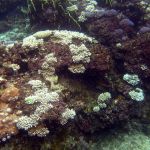
Assessing the sustainability of culturally important marine sites in Guam and CNMI
PI: Laurie Raymundo, Professor of Marine Biology, University of Guam
Co-PI: Jeffrey Maynard, Marine Applied Research Center
Funded: FY2015
Co-PI: Jeffrey Maynard, Marine Applied Research Center
Funded: FY2015
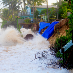
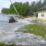
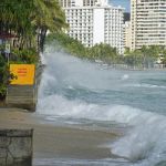
Projecting the frequency and impact of future coastal fooding and inundation events in the Pacific Islands
PI: Philip Thompson, Assoc. Director of UH Sea Level center, UH Mānoa
Co-Is: Matthew J. Widlansky, International Pacific Research Center, UH Mānoa; Janet M. Becker, Professor of Geology, UH Mānoa; Mark A. Merrifield, Professor of Oceanography, UH Mānoa; John J. Marra, Regional Climate Services Director, NOAA
Funded: FY2015
Co-Is: Matthew J. Widlansky, International Pacific Research Center, UH Mānoa; Janet M. Becker, Professor of Geology, UH Mānoa; Mark A. Merrifield, Professor of Oceanography, UH Mānoa; John J. Marra, Regional Climate Services Director, NOAA
Funded: FY2015
Multi-year sea level predictions for the Pacific Ocean
PI: Axel Timmermann, International Pacific Research Center, UH Mānoa
Co-PI: Matthew Widlansky, International Pacific Research Center, UH Mānoa
Funded: FY2015
Co-PI: Matthew Widlansky, International Pacific Research Center, UH Mānoa
Funded: FY2015