Multi-year sea level predictions for the Pacific Ocean
Project Objectives
The main objective of our project is to develop a sea level prediction system for the Pacific Islands with lead times of up to 10 years. We will communicate real-time sea level forecasts and corresponding uncertainty estimates. Using a combination of tide gauge data, satellite altimeter observations, ocean re-analyses, existing seasonal prediction products, and our climate prediction framework, we are working to address the following key science questions:
- How well do climate models capture the dynamics of sea level variability in the tropical Pacific?
- What is the seasonal to decadal forecasting skill for sea level extremes in our recently developed Community Earth System Model (CESM) initialized forecasting system?
- How does the skill of our dynamical forecasting system compare with other statistical predictions and existing dynamical forecasting systems?
- How should seasonal to decadal sea level forecasts best be communicated to stakeholders (e.g., coastal resource managers, government agencies, and conservation groups)?
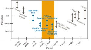
Magnitudes and timescales of sea level variability in the tropical Pacific
In the figure to the right, orange shading indicates our target forecast lead time: three months to 10 years. Mechanisms contributing to multi-year sea level variability are blue. We do not consider factors in grey in our prediction framework.
Preliminary results
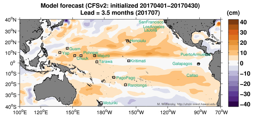
We explored the dynamics of sea level variability associated with El Niño in observations (Widlansky et al. 2014) and our CESM forecasting framework (i). To determine forecast skill (ii), we are initializing hindcast ensemble predictions from two assimilation runs using ocean re-analyses (NOAA’s GODAS and ECMWF’s ORA) for the 1981–2015 period. We plan to compare our hindcast skill with operational dynamical forecasts from NOAA (CFSv2) and Australia (POAMA) as well as statistical models (iii) before conducting real-time predictions.
Stakeholder relevance
New forecast diagnostics will be developed and communicated for an early warning of future sea level extremes (iv). Recently we showed that extreme low and high sea level stands are likely to become more frequent with greenhouse warming (Widlansky et al. 2015) even as global sea levels continue to rise, further motivating the need for well-validated sea level predictions.
References
Widlansky, M.J., Timmermann, A., McGregor, S., Stuecker, M.F., & Cai, W. (2014). An interhemispheric tropical sea level seesaw due to El Niño Taimasa. J. Climate, 27(3), 1070-1081. doi:10.1175/JCLI-D-13-00276.1
Widlansky, M.J., Timmermann, A., & Cai, W. (2015). Future extreme sea level seesaws in the tropical Pacific. Science Advances, 1(8), e1500560, doi:10.1126/sciadv.1500560
PROJECT DETAILS
FUNDED:
FY2015
PI:
Axel Timmermann
International Pacific Research Center, UH Mānoa
Co-PI:
Matthew Widlansky
International Pacific Research Center, UH Mānoa