CLIMATE PREDICTION AND TESTING
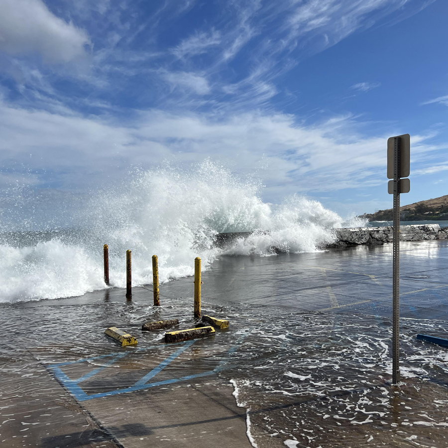
HERA: Impact of Sea Level Rise and Storms on Coastal Flooding Hazards
The USGS HERA-Impact of Sea Level Rise and Storms on Coastal Flooding Hazards tool provides important scientific information for decisionmakers throughout the Pacific to plan for future coastal flooding events.

Machine learning for high-resolution downscaling in the Hawaiian Islands
PI: Peter Sadowski, Associate Professor of Computer Science, UH Mānoa
Graduate Scholar: Yusuke Hatanaka Dept of Information and Computer Science, UH Mānoa
Co-I: Thomas Giambelluca, Professor of Geography, UH Mānoa
Funded: FY2024
Graduate Scholar: Yusuke Hatanaka Dept of Information and Computer Science, UH Mānoa
Co-I: Thomas Giambelluca, Professor of Geography, UH Mānoa
Funded: FY2024

Refining precipitation model projections for the Hawaiian Islands using generative machine learning
PI: Peter Sadowski, Associate Professor of Computer Science, UH Mānoa
Co-I: Thomas Giambelluca, Professor of Geography, UH Mānoa
Funded: FY2024
Co-I: Thomas Giambelluca, Professor of Geography, UH Mānoa
Funded: FY2024

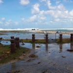
American Samoa Sea Level Rise Viewer
This interactive web tool provides access to sea-level rise information for decisionmakers and community members to plan for the impacts of rising sea levels in American Samoa.
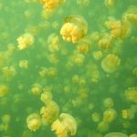
Predicting and managing the future of Ongeim’l Tketau (Jellyfish Lake), Palau in a changing climate
PI: Romina King, Associate Professor of Geography, University of Guam
Co-PI: Sharon Patris, Research Biologist, Coral Reef research Foundation
Funded: FY2023
Co-PI: Sharon Patris, Research Biologist, Coral Reef research Foundation
Funded: FY2023
Pacific Islands Sea Level Rise Project Explorer
Sea-level rise impacts are prevalent throughout the Pacific, as is the research to adapt to those impacts. This new interactive tool compiles information about SLR projects in one place to help avoid duplication of efforts and encourage collaborations for future work.
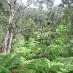
Assessing the success and vulnerability of Hawaiian rare plant introductions to inform future stabilization efforts
PI: Tamara Ticktin, Professor of Botany, UH Mānoa
Graduate Scholar: Julia Douglas, School of Life Sciences, UH Mānoa
Co-Is: Clay Trauernicht, Associate Specialist, UH Mānoa; Tim Chambers, Center for Plant Conservation Officer, ANRPO; Lucas Fortini, Research Ecologist, PIERC, USGS
Funded: FY2023
Graduate Scholar: Julia Douglas, School of Life Sciences, UH Mānoa
Co-Is: Clay Trauernicht, Associate Specialist, UH Mānoa; Tim Chambers, Center for Plant Conservation Officer, ANRPO; Lucas Fortini, Research Ecologist, PIERC, USGS
Funded: FY2023
Developing a climate-resilient restoration approach combining functional, climate, and geographic data
PI: Rebecca Ostertag, Professor of Biology, UH Hilo
MCC Graduate Scholar: Konapiliahi Dancil, TCBES, UH Hilo
Co-I: Jonathan Price Professor of Geography, UH Hilo
Funded: FY2022
MCC Graduate Scholar: Konapiliahi Dancil, TCBES, UH Hilo
Co-I: Jonathan Price Professor of Geography, UH Hilo
Funded: FY2022

Sea Level Rise AR Visualizer for Puʻuhonua o Honaunau Park
This augmented reality app lets you visualize the future of sea-level rise at Pu’uohonua o Honauanua National Historical Park as if you were cruising over the peninsula in a helicopter!
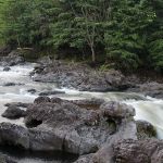
Shifts in carbon exports from a Hawaiian watershed under a changing climate
PI: Tracy Wiegner, Professor of Marine Science, UH Hilo
Graduate Scholar: Walter Boger, TCBES, UH Hilo
Co-PIs: Steven Colbert, Assistant Professor of Marine Science, UH Hilo
Funded: FY2022
Graduate Scholar: Walter Boger, TCBES, UH Hilo
Co-PIs: Steven Colbert, Assistant Professor of Marine Science, UH Hilo
Funded: FY2022