Sea Level Rise AR Visualizer for Puʻuhonua o Honaunau Park
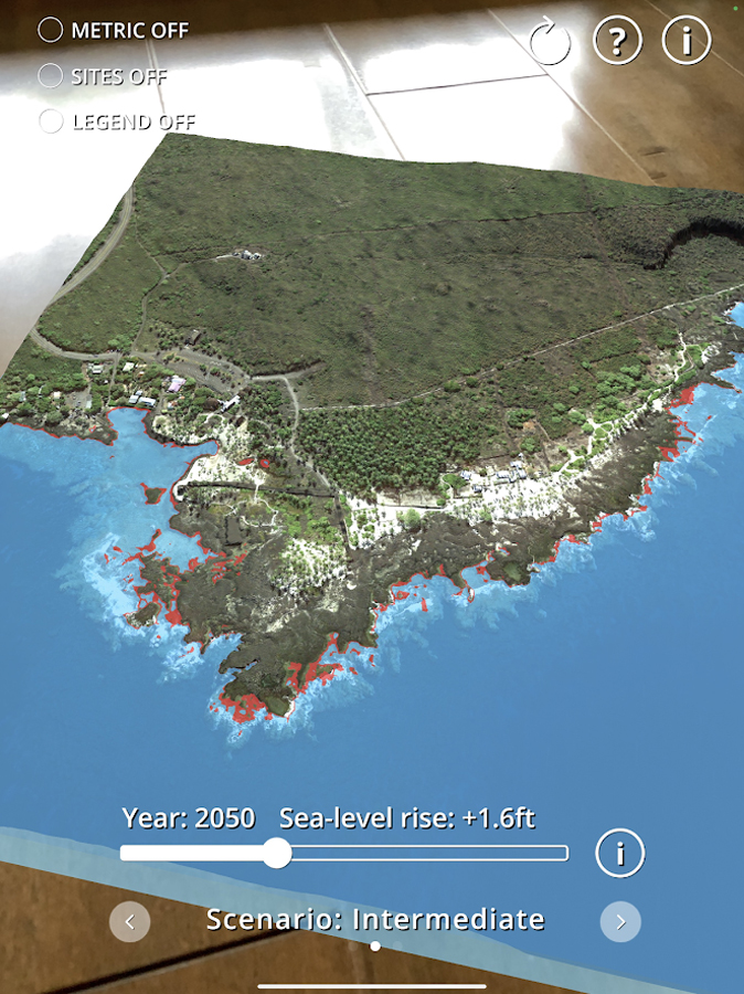
Visualize the extent of sea-level rise in Pu‘uhonua o Hōnaunau National Historical Park as if you are at the controls of your own helicopter! The Sea Level Rise AR Visualizer uses augmented reality (AR) technology to create a virtual model of Pu‘uhonua o Hōnaunau National Historical Park, allowing you to explore how sea-level rise will affect this important cultural and historic Hawaiian site.
The app is based on high-resolution topobathymetric data from a LIDAR and structure-from-motion survey led by Jeff Danielson and Dean Gesch at the USGS Coastal National Elevation Database (CoNED). Using augmented reality, this data is combined with sea-level rise projections published by NOAA to create this informative outreach tool illustrating high tide levels around the park under conditions predicted using three different sea-level rise scenarios. It is currently available for iOS and android systems.
PROJECT DETAILS
TYPE:
Tool/App
PEOPLE:
Phil Thompson
Assistant Professor/Director, UH Sea Level Center, UH Mānoa
Nemanja Komar
Scientific Programmer, UH Sea Level Center, UH Mānoa