The impact of sea-level rise on coral reef and mangrove interactions and the resulting coastal flooding hazards
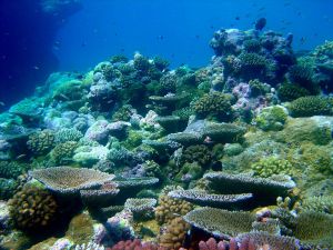
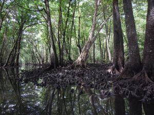
Ecosystems such as coral reefs and mangroves provide an effective first line of defense against coastal hazards and represent a promising nature-based solution to adapt to sea-level rise. In many areas, coral reefs cause waves to break and lose energy, allowing for sediment to accumulate on the inshore portion of reef flats (i.e. the shallowest, flattest part of a reef) and for mangroves to establish. Mangroves cause further attenuation (i.e. energy loss) of waves and storm surge as water moves through the roots and trunks of the trees. Together, these ecosystems provide valuable protection from coastal flooding, but is unclear how this protection may be affected by sea-level rise. An assessment of future sea-level rise vulnerability for coral reef- and mangrove-lined coasts in the Federated States of Micronesia is essential to support climate change adaptation strategies for individual island states and their communities into the future.
Sea-level rise will likely reduce the wave protection provided by coral reefs and thus could cause changes in mangrove forest extent and composition. This, in turn, would reduce coastal protection from flooding during large storm events. The science team will assess how reef protection allows mangrove forests to develop, how that balance will be impacted by sea-level rise, and the resulting changes to coastal flooding hazards caused from changes in mangrove forest extent and composition on Pohnpei in the Federated States of Micronesia.
This proposed research will focus on empirical data synthesis and spatially-explicit model development to inform stakeholder planning. Products for planners will include maps and charts visualizing projections of how waves, wave-driven water levels, and mangrove forest extents and compositions will change for different sea-level rise scenarios. These products will provide sound scientific guidance for current and future management decisions, as well as allow for effective communication of the findings to the public. This work will be transferable to other U.S. and U.S.-affiliated island communities with mangroves such as Kosrae, Palau, Yap, Puerto Rico, and the U.S. Virgin Islands, by providing a framework and protocol for application to other islands.
PROJECT DETAILS
FUNDED:
FY2020
PI:
Curt Storlazzi
Research Geologist, USGS Pacific Coastal and Marine Science Center
Co-I:
Karen Thorne
Research Ecologist, USGS Western Ecological Research Center
Collaborators:
Ken Krauss
Research Ecologist, Wetland and Aquatic Research Center
Richard MacKenzie
Research Ecologist, US Forest Service
Kevin Buffington
Ecologist, Western Ecological Research Center
Michael Beck
Research Professor of Marine Sciences, University of California Santa Cruz