The future resiliency of mangrove forests to sea-level rise in the Western Pacific: Initiating a national assessment approach

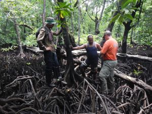
(Photo: KThorne/USGS)
Sea-level rise will eventually flood and kill many coastal mangrove trees. The loss of mangrove forests will strongly affect human populations on isolated western Pacific islands as they rely heavily on mangroves for food, such as fish, shrimp, and crabs; building materials; and fire wood. Mangroves also shelter coastal communities from the impacts of tsunamis and cyclones, are home to endangered species such as the Yapese monarch and flying fox, and remove and store CO2 from the atmosphere. In the past, mangroves have adjusted to sea-level rise through tree root growth and the accumulation of sediments from rivers and oceans, processes which allow them to maintain their forest floor elevation relative to sea level. However, in light of the projected acceleration of the rate of sea-level rise, as well as modifications made to coastal environments that impede their ability to respond, it is unclear how mangrove forests will respond to future conditions.
Identifying which mangrove forests are most affected by sea-level rise allows us to determine how to protect them today so that they can continue to support humans and wildlife tomorrow. Mangroves in the western Pacific contain some of the most pristine and productive ecosystems in the world, but very little data is available in this region to predict mangrove vulnerability or resilience. This project is building on an existing mangrove monitoring network created by the U.S. Forest Service, the USGS, and the Micronesia Conservation Trust in the Federated States of Micronesia to assess the vulnerability of mangrove forests to sea-level rise to inform management planning. Focusing on the islands of Kosrae and Pohnpei in the Federated States of Micronesia, researchers will identify which mangroves are keeping up with sea-level rise and which are not, and then model potential changes in the ecosystems that could occur.
This information will then be shared with state management agencies and local conservation organizations on both islands, including the Conservation Society of Pohnpei and the Kosrae Island Resource Management Authority, so that managers can identify what can be done to increase the ability of mangroves to keep up with sea-level rise. For example, moving roads or bridges so that mangroves can migrate inland or restoring connections to streams so that sediments can be deposited onto the mangrove forest floor could both support mangrove resiliency. Meanwhile, mangroves that are building elevation and adapting to sea-level rise should be protected from deforestation and maintained in that state for as long as possible. Increasing or protecting the ability of mangroves to keep up with sea-level rise will mean that these ecosystems can continue their role of supporting subsistence economies and diverse ecological communities in the Pacific Islands.
PROJECT DETAILS
FUNDED:
FY2019
PI:
Karen Thorne
Research Ecologist, USGS Western Ecological Research Center
Co-PI:
Richard MacKenzie
Research Ecologist, US Forest Service