A new dimension: 3D coral reef mapping gives unprecedented look into Guam’s coastal marine habitats
With much of Guam’s marine habitats left unmapped and unseen by many, one ambitious project is using advanced sensing technology to reveal what lies beneath the surface — starting with the island’s vital coral reefs.
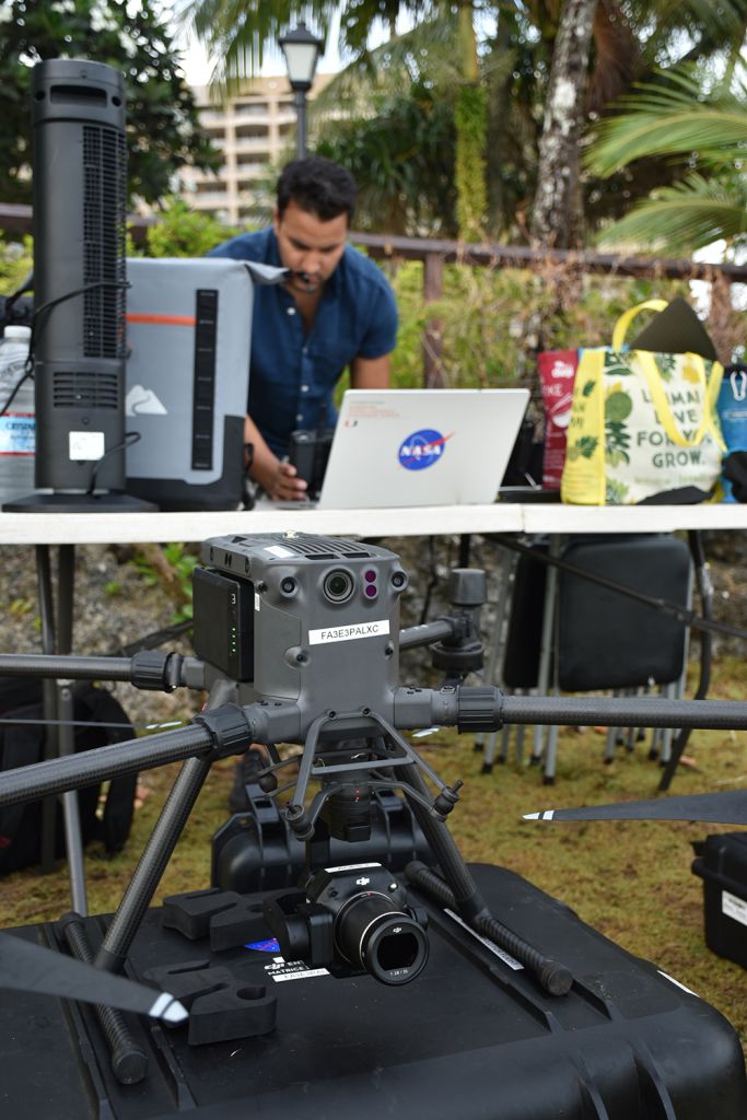
Project leads Dr. Ved Chirayath and Dr. Romina King are using NASA technology and local resources to produce centimeter-scale, three-dimensional maps of corals that will help managers assess the overall health of Guam’s priority reefs. The products from this mission can highlight critical information, such as the rate of bleaching events, the success of coral restoration of a period of time, and how reef structures are affected due to climate change impacts and human activity.
“This unprecedented precision mapping is made possible through Fluid Lensing, which I developed that cuts through the distortion of ocean waves and provides clear images of shallow marine habitats from above. With this technology, we can build upon what we know about Guam’s reefs through a new perspective and provide technical assistance to the managers who help protect them,” said Chirayath, who is the G. Unger Vetlesen Endowed Professor of Earth Sciences, Director of the Aircraft Center for Earth Studies (ACES), and National Geographic Explorer at the University of Miami’s Rosenstiel School of Marine and Atmospheric Science. Chirayath was previously the director of the NASA Laboratory for Advanced Sensing.
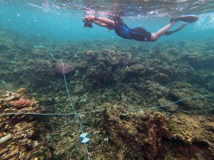
From May 21 to June 20, Chirayath and King led a team of drone pilots and volunteer free divers to collect photogrammetry data from three of Guam’s marine preserves — Tumon Bay, Piti Bomb Holes and the Achang Reef Flat — and other sites of interest, like Sharks Cove and Ague Cove. The collected imagery will later be processed and rendered to create the high-accuracy maps, which are also able to show some of the sea creatures that dwell in those habitats.
“We were able to map more than we initially planned for this particular field campaign, which we are proud of. This work has not only been a service to our coastal reef ecosystems, but also to local capacity building. By training more drone pilots, we will be able to do more of these excursions and eventually map most of Guam’s coastal marine habitats. We are grateful to Dr. Chirayath for lending his resources to provide much-needed data for our island community,” King said. King is an associate professor of geography at the University of Guam, the UOG lead for the Pacific Islands Climate Adaptation Science Center, and associate director of NASA Guam Space Grant.
In particular, PI-CASC is helping to fund the use of MIDAR technology as a tool for resource managers to monitor coral reefs during bleaching events. The project will determine how well NASA technology can assess the effects of coral bleaching over a wider geographic area, and the effectiveness of restoration efforts. King and Chirayath are Co-principal investigators of this PI-CASC project.
Sharing to the community
In addition to field work, the team also conducted outreach at various educational levels to share the significance of this project. Joined by Field Campaign Manager and University of Miami graduate student Stephanie Wright, Chirayath shared highlights of the project to middle school, high school and college undergraduate students. Chirayath also presented data products to natural resource managers, scientists, and government officials during a technical presentation and overview on June 20 at the Ricardo J. Bordallo Governor’s Complex.
“Our coral reef ecosystems feed and protect our island community as well as support our economies. In return, we must do what we can to preserve them. I am hopeful that the products that come out from this project will be instrumental in managing our coral reefs and determining the best courses of action for preventing or mitigating and harm that comes to them,” Guam Gov. Lourdes Leon Guerrero said.
Multi-agency partnership
This year’s field campaign was the second phase of the 3D Coral Mapping of Guam’s Priority Reefs project. The first phase took place in 2019 for the Tumon Bay and Piti Bomb Holes Marine Preserves, and Chirayath shared the results of that campaign this year.
Phase 1 of this project was primarily funded through a grant from the Department of the Interior Coral Reef Initiative and administrated by the Guam Bureau of Statistics and Plans. Other funders and partners include NASA, University of Guam, University of Miami, Guam Department of Agriculture, PI-CASC, NASA Guam EPSCoR, NASA Guam Space Grant, and the National Park Service.

I am hopeful that the products that come out from this project will be instrumental in managing our coral reefs and determining the best courses of action for preventing or mitigating and harm that comes to them.— Guam Gov. Lourdes Leon Guerrero