COASTAL HAZARDS

Restoring Hawai‘i’s Wetlands
PI: Kelly Goodale, Biologist, USFWS, Oʻahu National Wildlife Refuge Complex
Funded: FY2024
Funded: FY2024

2024 SURF Projects
Four students completed projects in climate adaptation science for the 2024 SURF program, investigating the effects of ocean warming on cleaner wrasse behavior, finding the best soil amendments for encouraging native Hawaiian plant regeneration, modeling the optimal pathway for using the RAD framework on Hawaiʻi biomes, and using non-intrusive methods to investigate climate effects of coral growth rates.
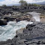
Evaluating the resilience of productive rocky intertidal ecosystems to SLR using a community-based approach
PI: Haunani Kane, Assistant Professor of Earth Sciences, UH Mānoa
Graduate Scholar: Makoa Pascoe, Dept of Oceanography, UH Mānoa
Co-Is: Atsuko Fukunaga, Assistant Researcher, CIMAR, UH Mānoa; John Burns, Associate Professor of Marine Science, UH Hilo; Kainalu Steward, Dept of Earth Sciences, UH Mānoa
Funded: FY2024
Graduate Scholar: Makoa Pascoe, Dept of Oceanography, UH Mānoa
Co-Is: Atsuko Fukunaga, Assistant Researcher, CIMAR, UH Mānoa; John Burns, Associate Professor of Marine Science, UH Hilo; Kainalu Steward, Dept of Earth Sciences, UH Mānoa
Funded: FY2024
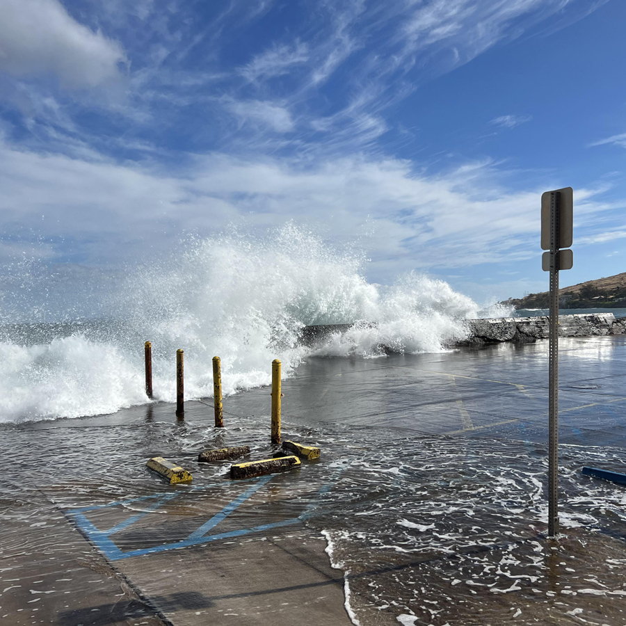
HERA: Impact of Sea Level Rise and Storms on Coastal Flooding Hazards
The USGS HERA-Impact of Sea Level Rise and Storms on Coastal Flooding Hazards tool provides important scientific information for decisionmakers throughout the Pacific to plan for future coastal flooding events.
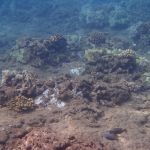
Assessing the sensitivity of coral reef accretion and bioerosion to acidification and eutrophication
PI: Andrea Kealoha, Asst. Professor of Oceanography, UH Mānoa
Graduate Scholar: Raffi Isah, Dept of Oceanography, UH Mānoa
Co-I: Katie Shamberger, Assoc. Professor of Oceanography, Texas A&M University
Funded: FY2024
Graduate Scholar: Raffi Isah, Dept of Oceanography, UH Mānoa
Co-I: Katie Shamberger, Assoc. Professor of Oceanography, Texas A&M University
Funded: FY2024
Effects of climate-driven increases in sediment delivery on coral reef ecosystem productivity and accretion
PI: Andrea Kealoha, Asst. Professor of Oceanography, UH Mānoa
Graduate Scholar: Sean Swift, Dept of Oceanography, UH Mānoa
Co-I: Craig Nelson, Assoc. Researcher of Oceanography, UH Mānoa
Funded: FY2024
Graduate Scholar: Sean Swift, Dept of Oceanography, UH Mānoa
Co-I: Craig Nelson, Assoc. Researcher of Oceanography, UH Mānoa
Funded: FY2024
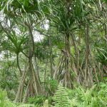
Community value-based management of coastal Pandanus forests to mitigate the effects of climate change in Hawaiʻi
PI: Nina Rønsted, Deputy Director of Research, Natural History Museum of Denmark
Graduate Scholar: Tehina Kahikina, Dept of Hawaiian Studies, UH Mānoa
Co-Is: Tim Gallaher, Botanist, Bernice Pauahi Bishop Museum; Tamara Ticktin, Professor of Botany, UH Mānoa; Kalikoaloha Martin Instructor, Hawaiʻinuiākea School of Hawaiian Knowledge, UH Mānoa
Funded: FY2024
Graduate Scholar: Tehina Kahikina, Dept of Hawaiian Studies, UH Mānoa
Co-Is: Tim Gallaher, Botanist, Bernice Pauahi Bishop Museum; Tamara Ticktin, Professor of Botany, UH Mānoa; Kalikoaloha Martin Instructor, Hawaiʻinuiākea School of Hawaiian Knowledge, UH Mānoa
Funded: FY2024
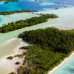
Vegetation and climate reconstructions for Palmyra Atoll to develop adaptation strategies for lowland plant communities
PI: David Wahl, Research Scientist, Geology, Minerals, Energy and Geophysics Science Center, USGS
Co-Is: Miriam Jones, Research Geologist, USGS; Kelly Goodale Wildlife Biologist, US Fish and Wildlife Service
Funded: FY2024
Co-Is: Miriam Jones, Research Geologist, USGS; Kelly Goodale Wildlife Biologist, US Fish and Wildlife Service
Funded: FY2024

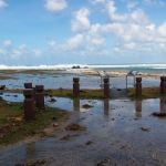
American Samoa Sea Level Rise Viewer
This interactive web tool provides access to sea-level rise information for decisionmakers and community members to plan for the impacts of rising sea levels in American Samoa.
Pacific Islands Sea Level Rise Project Explorer
Sea-level rise impacts are prevalent throughout the Pacific, as is the research to adapt to those impacts. This new interactive tool compiles information about SLR projects in one place to help avoid duplication of efforts and encourage collaborations for future work.